Consolidated Goldfields Corporation (CDGF) is offering for exclusive sale a complete modern data set covering this property.
The Muskox intrusion is one the last undeveloped world-class Nickel-Copper-Platinum Group Element (PGE) prospects. Consolidated Goldfields Corporation (CDGF) is offering for exclusive sale a complete modern data set covering this property. It represents a significant investment of time and money and would allow the owner to begin an advanced exploration program immediately.
The Muskox intrusion, located in northern Canada, is within a geological environment strikingly similar to that hosting the Noril’sk/Talnakh deposits, the world’s greatest accumulation of mineral wealth on the planet. To date the potential for the Muskox intrusion to host mineralization on the scale of the Noril’sk property has barely been tested but a significant data base is available for timely and efficient exploration.
The majority of the world’s PGE production is from Russia or South Africa and exploration of the Muskox intrusion presents an opportunity to discover a significant PGE deposit in a politically stable jurisdiction. CDGF is offering the data set on the entire region hosting the geologically favorable intrusion. Dr. Larry Hulburt, an acknowledged world expert in ultramafic ore deposits and especially the Muskox property, organized and managed the data set.
Location

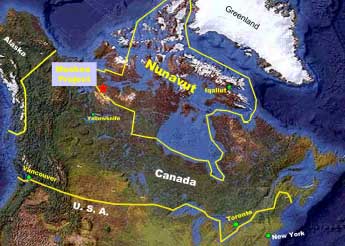
The Muskox Intrusion lies some 512 km (320 miles) north of Yellowknife, NT and 96 km (60 miles) south of Kugluktuk (Coppermine), NU, northern Canada. See figure below.
Geology
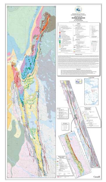
The Muskox Intrusion is one of the largest and least deformed layered mafic to ultramafic bodies in the world. It intruded as an elongate funnel-shaped body along a feeder dyke to the Coppermine flood basalts, at or near the unconformity between the underlying Early Proterozoic (1.8 to 2.1 Ga.) schists and gneisses of the Coronation Supergroup (Hoffman, 1981) and the overlying undeformed rocks of the Hornby Bay and Dismal Lake groups (the basal strata of the Coppermine Homocline). The exposed portion of the intrusive complex is approximately 125 km long, and ranges in width from 200m – 600m in the keel dyke to 11 km in the main body of the intrusion. Three deep drill holes collared by the Geological Survey of Canada during the 1960’s intersected a stratigraphic thickness of 1,900 m in the central exposed portion of the intrusion. Magnetic data indicate that the intrusion continues at least 100 km to the north of the last exposure, under the Coppermine Homocline. Gravity data suggest that it is even larger, and may continue northward for 250 km from its northernmost exposure.
The following is an example of mineralization within two intervals of a drill hole from one of prospective areas within the intrusion :
Pyrrhotite Lake Drilling Results

Data Set
The data set offered here represents over 15 years of exploration and 4 multi-year programs conducted back to 1955. Almost every bedrock exposure has been investigated and more than 1100 surface samples have been collected along the tens of kilometers of gossan that continuously strike the margins of the intrusion.
The intrusion has been the target of greater than 5600 line kilometers of airborne magnetic and EM surveys, 466 line kilometers of ground geophysical surveys which include VLF, HLEM, Gravity, MT, and AMT. At least 4100m of borehole geophysics and 238 diamond drill holes totaling more than 34,000m of core; three of these were completed by the CSG
The data package includes the following:
- Geological, maps/ cross sections,
- Geochemical, soil, rock chip samples
- Geophysical, magnetic, gravity, and other electromagnetic surveys
- Drilling results, logs/assays
- Reports/presentations-interpretative discussions
- CGS reports and data
- Anglo company reports
- BH company reports
- Silvermet company reports
- Muskox Minerals company reports
Additional Data and Information:
For a more detailed look at the data set, or discussion about terms of sale and contract details please visit our Contact Page


